Next to the church in the tiny village of Noughaval, on the southern edge of the Burren lowlands in Co. Clare, a few kilometres northeast of Kilfenora, stands a lone stone pillar by the roadside. It is known variously as the market stone, bandle stone, bandle cross and market cross.
The monument is a freestanding, octagonal, stone-cut pillar or pier topped by a tapered cap. It is set into a two-stepped rectangular base, which sits on a rectangular plinth. The total height of the monument is nearly 2.2m. Made of limestone, the pillar is punch-dressed and features a series of incised horizontal lines but is otherwise uninscribed and undecorated.
Archaeologist Dr Richard Gray identifies the masonry style as typical of the 15th to 17th centuries. Martin Breen and Ristéard UaCróinín argue that the system of building – where each course consists of two identical stones facing each other – was not unknown in late medieval Ireland, and yet they date the monument to the early 17th to mid-18th centuries. The National Inventory of Architectural Heritage assigns a date of c.1725 but does not provide an explanation for this date.
Was it a cross?
Despite its proximity to an early medieval church site, the monument was not recorded in the Ordnance Survey (OS) Letters discussing the site. However, it does appear on all OS maps, marked “Noughaval Cross” or simply “Cross”. The 1844–45 Parliamentary Gazetteer of Ireland noted that “the principal antiquities” in the parish are “the cross and the ruined church”. Clare historian James Frost, writing in 1893, described it as
“a stone pillar, without any inscription, but which is said to be a market cross, with certain lines drawn upon it to serve as measures of length for the people.”
A F F I L I A T E A D

An 1896 issue of the Journal of the Association for the Preservation of the Memorials of the Dead in Ireland claimed that it formed “the lower part of the medieval market cross”, as did Limerick antiquarian T.J. Westropp, writing in 1897 and 1900. He added that it showed that “this obscure little place was of importance in medieval times”. In 1909, Westropp further elaborated, stating that it was “reputed to be the market cross of the long vanished ‘town’” and noted that “certain marks on it were said to have been used as measures for cloth and other materials sold at the fairs”. The National Monuments Service also classifies the stone as a market cross, defining such monuments as “a cross found in a market place”, with dates ranging from the 5th to 19th centuries.
In reality, there is no indication that the monument is incomplete. So, while it is not a cross in the traditional sense, lacking as it does the typical cruciform shape, it does share similarities with late medieval and post-medieval “market crosses” commonly found in marketplaces across Britain and Western Europe. Over time, the traditional cruciform shape of market crosses was often abandoned in favour of a pillar form, yet the term “market cross” continued to be used for such monuments.
We have much documentary evidence referring to market crosses in Ireland, but the monument type remains poorly understood. This is possibly due to their low survival rate, likely because many were made of timber.
However, one Irish monument bears a striking resemblance to the Noughaval stone – the O’Daly Monument at Parkmore Quay in the townland of Ballyvelaghan near Finavarra, in north Clare. Both are remarkably similar in material, design and masonry style, suggesting they may have been carved by the same mason. The main difference lies in their shape: the Noughaval pillar is octagonal in plan, while the Finavarra pillar is hexagonal. The Finavarra pillar is also larger and more visually impressive. Both are likely market stones – or, if you prefer, market crosses – used to calibrate and standardize local measurements of length.
What’s a bandle?
In Noughaval, the commonly used terms “bandle stone” and “bandle cross” reflect the monument’s role as a measuring tool, a practice first recorded by James Frost. A bandle, or “bann-lámh“, was a linear unit of measurement used in Ireland, particularly for measuring linen. It measured around 2 feet or 24 inches but could vary from place to place, ranging between 20 and 30 inches. Hely Dutton noted in 1808 that a bandle in Galway was 30 inches, while in Limerick it was 21 inches.
In Clare, the measurement was sometimes made by using seven fingers four times, but more often, a tool was used to perform the measurement. For example, an entry in the Schools’ Folklore Collection (c.1937) describes how old people in Ballinderreen, Co. Galway, kept a stick in their homes called a bandle, which they used to measure flannel. But in some places, there was a communal tool for measuring cloth, as in the case of Noughaval.
The circumference of the Noughaval stone is 72 inches, which aligns well with the 24-inch bandle, as one full turn of fabric around the stone equals 72 inches or 3 bandles. This also equals 2 yards since a yard is 36 inches, and cloth was also often measured in yards.

It’s important to note that before the Weights and Measures Act of 1824, Irish people used their own systems of measurement, which were distinct from the British imperial system. Irish inches and yards were longer than the imperial units but could vary depending on location. The inch and yard measurements used here are based on the post-1824 imperial system, and the actual measurements that the Noughaval stone was based on would likely have been influenced by older Irish practices, which may not directly correspond to imperial units.
Linen cloth was produced in the west of Ireland during the late medieval and post-medieval periods for home use as well as export. According to local tradition, flax was widely grown in the Noughaval area, where it was processed in a series of stages, including retting, breaking, scutching and heckling, before being spun and woven into linen. Spinning was an important task, often carried out by women. A type of coarse, narrow linen known as “bandle cloth” or “bandle linen” continued to be produced in parts of Clare throughout the 18th and 19th centuries.
Wool was also likely produced in the area. Local weavers would have produced woollen fabrics such as frieze, flannel and later tweed for both domestic use and trade.
The textiles would have been measured using the communal bandle stone in Noughaval before being traded at the local market and sold by the bandle or yard. The stone was likely used also to measure rope and twine and perhaps even leather and hides. Therefore, the bandle stone at Noughaval is evidence of standardizing and regulating measurement practices on a local level.
Noughaval market
As Richard Gray’s research has shown, there is no known surviving patent or documentary evidence indicating when a market was first established at Noughaval or how it developed and eventually declined. This may be due to the location of Noughaval within the Ó Lochlainn lordship of Burren, near its southern boundary – a region that maintained a strong Gaelic identity throughout the late medieval period.
The area’s poor agricultural land likely partly contributed to the preservation of the Gaelic culture. Samuel Lewis, writing in 1837, remarked on the land’s poor quality, noting that only a small portion of Noughaval parish was under tillage, with “the greater part consisting of rocky limestone pasture, yielding rich, though scanty herbage.”
An abandoned settlement
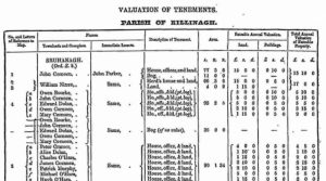
Despite the poor land, multiple strands of evidence suggest that Noughaval parish remained well populated throughout the late medieval, post-medieval and early modern periods. The “census” of 1659 recorded an adult population of 141 in the parish, 42 of whom were in Noughaval townland – a disproportionately high number for this region (interestingly, Finavarra also had a relatively high population for this part of Clare). In 1837, Lewis recorded 408 inhabitants in Noughaval parish, with 64 in Noughaval itself.
A F F I L I A T E A D

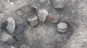
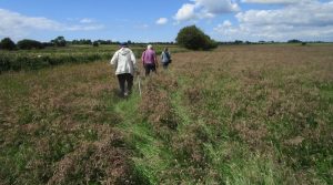
The remains of the abandoned settlement at Noughaval stretch across fields to the east, south and southwest of the bandle stone. These visible remains include a cluster of over a dozen houses or potential houses, as well as associated field walls and enclosures. However, the true extent of the settlement was likely much larger. Some structures may have been removed during later land improvements, while houses built of sod and wattle would have left minimal traces due to their ephemeral nature.
Excavation
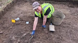
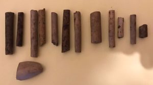
In the early 1990s, Dr Sinéad Ní Ghabhláin led an excavation of a house less than 100m southeast of the bandle stone at Noughaval, recovering quantities of animal bone, domestic material and various artefacts dating to the 17th century and later. Beneath this, an earlier occupation layer indicated late medieval activity, with finds including a polished bone die closely resembling 13th-century examples from the Dublin excavations.
Work by Ní Ghabhláin and Dr Eve Campbell has demonstrated that there were numerous dwellings in Noughaval likely dating to the late medieval and post-medieval periods. The settlement appears to have developed organically rather than being planned, with different parts developing at different times.
Given the land’s limitations, the inhabitants could not have relied solely on traditional farming practices. Instead, they were likely engaged in textile production and other specialist crafts, with the products sold at the local market. We can, therefore, make the case that this market-driven economy played a key role in the formation and endurance of the community at Noughaval.
Of course, the presence of the early church site at Noughaval indicates that a community lived here during the early medieval period too. In fact, the townland of Noughaval is teeming with archaeology, including a megalithic structure, cairns of various types and dates, hut sites, old field systems, stone forts, various types of enclosures and other structures. This indicates that Noughaval has a long history of habitation.
Noughaval’s early medieval church site
The placename Noughaval (Nuachabháil), sometimes rendered Nohavall in early sources, is generally translated as “new settlement, establishment or monastery”.
St Mogua
Tradition holds that the church at Noughaval was founded in the early medieval period by St Mogua, whose name is associated with a nearby holy well to the east, Tobermogua, meaning “Mogua’s well”. An ash tree beside the well is regarded as a holy tree. A modern church dedicated to St Mochua (Mogua) stands near the bandle stone.
No early sources record a St Mogua. The OS Letters of 1839 note that while the well was locally called “Tobar Mo Ghua” and an annual pattern was held there on 10 February, its true name was more likely Tobar Mic Duach. Similarly, Frost, writing in 1893, identified the well as being dedicated to St Colman MacDuach.

The pedigree of the early medieval saint Colmán of Kilmacduagh, or Ceall Mhic Dhuach, attaches him to the Uí Fhiachrach of Aidhne, a group that held lands in Galway and north Clare, roughly corresponding to the later diocese of Kilmacduagh. Some sources list Colmán among the children of Inghean Bhaoith of Killinaboy, not far from Noughaval. Colmán’s feastday is recorded in the martyrologies as 3 February, with its octave, 10 February, also marked by devotion – as at Noughaval.
YOU MIGHT ALSO LIKE:
> Medieval grave-slab at Killinaboy depicts forgotten relics
> Killinaboy’s disappearing and re-appearing tau cross
It is, therefore, plausible that Mogua is simply an alias for St Colmán of Kilmacduagh – a transformation that an Irish speaker would easily recognize, with Mac Duach naturally becoming Mogua in speech and later being recorded in writing in that phonetic form.